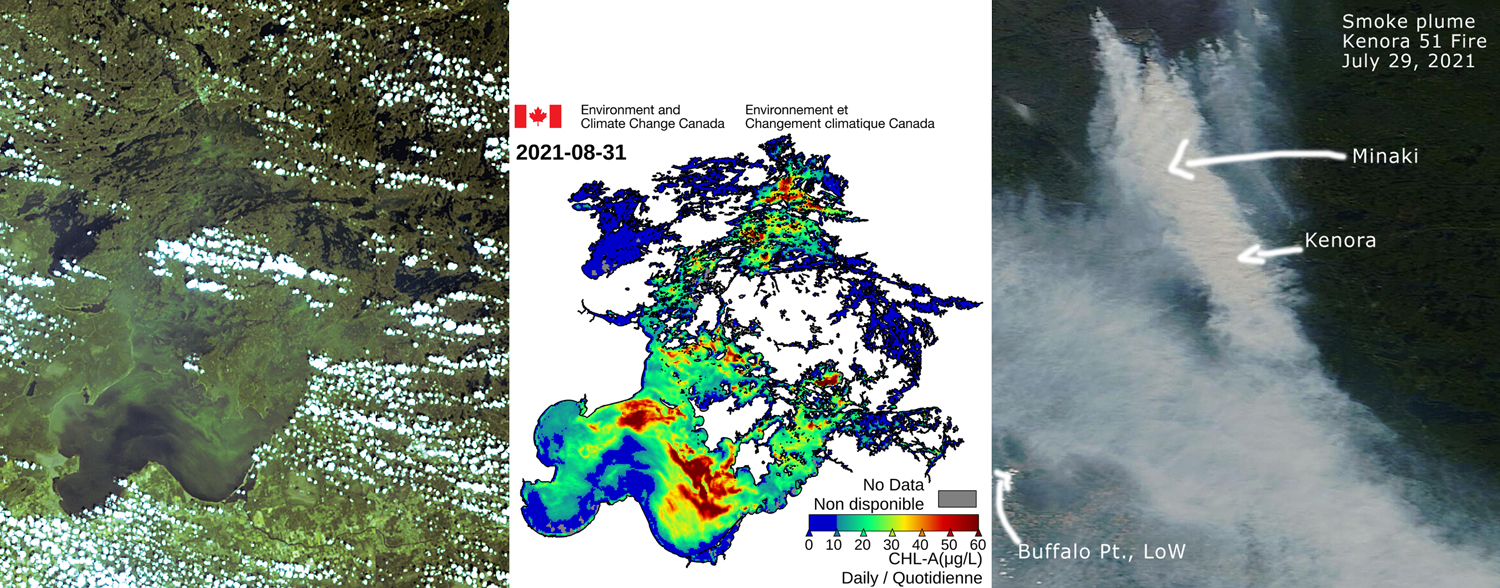
 Satellite image of Lake of the Woods algae bloom and derived chlorophyll-a levels August 31, 2021 (courtesy of Dr. Caren Binding, ECCC) plus smoke plume covering most of lake July 29, 2021
The seasonal algae bloom on Lake of the Woods is underway and has progressed up into the north end of the lake, as shown in the satellite image and associated derrived chlorophyll-a data for August 31.
For much of the summer, it seemed like a "light year" for algae blooms, but blooms began to develop in mid to late August. The low blooms in much of the mid-summer may perhaps be due to the low water and low flows from the nutrient-rich southern basin of Lake of the Woods, or perhaps lower light conditions due to the intense smoke that blanketed the lake throughout July and into the first week of August. The smoke conditions also likely limited the days for which the satellite tools could generate good chlorophyll-a estimates.
The satellite tools, developed by Dr. Caren Binding at Environment and Climate Change Canada, have much promise for long-term monitoring of trends in algae bloom intensity and severity. The ability of this technology is striking. However, at short-term time scales (e.g., daily to seasonal), we have to remember that this incredible technology has some limitations. It requires many days of clear skies for satellite image processing and extended periods of calm winds for surface blooms to form. The satellites are sensing surface blooms and not the amount of algae generally mixed throughout the water column and thus at short-term time scales can't really give us a measure of lake productivity or its response to reducing phosphorus. At longer (decadal) timescales, correlation of bloom intensity, severity, extent measures from the satellite tools may well prove useful in monitoring changes in the lake due to phosphorus control.
