Overview
Satellites provide frequent lake-wide observations which enable the detection and tracking of algal blooms on Lake of the Woods. Satellite images and derived bloom products allow us to study the day to day variability of algal blooms on the lake, inter-annual spatial and temporal trends in bloom severity, and further our understanding of the processes acting to drive their occurrence.
Location of Study
Lake of the Woods.
Researcher Profiles
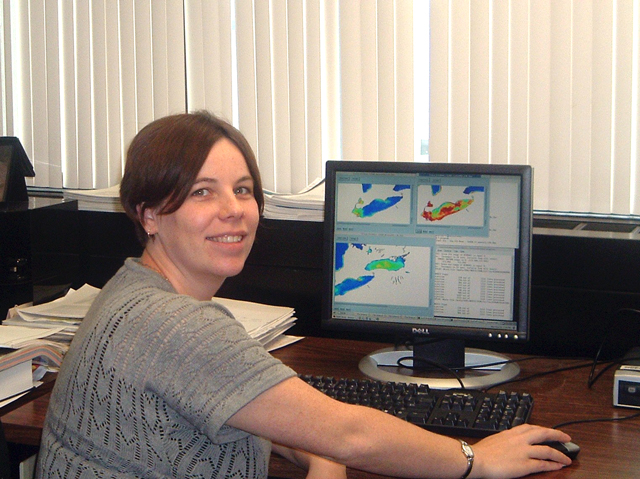 Caren Binding, Research Scientist with Environment and Climate Change Canada (ECCC)
My research focuses on aquatic optics and remote sensing for inland water quality applications. Using a combination of field and laboratory observations and theoretical modeling to determine how water constituents interact with light, I work on developing approaches to detect coloured water quality constituents from space. I use remote sensing imagery to determine spatial and temporal trends in water quality events such as algal blooms, furthering our understanding of the watershed, lake, and climate processes driving those events, and developing enhanced water quality monitoring capabilities.
Description of Study
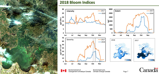 Caren Binding, Research Scientist leads Environment and Climate Change Canada algae satellite remote sensing program on Lake of the WoodsThe overall objectives of the project are to deliver comprehensive lake-wide observations of satellite-derived algal bloom conditions for Lake of the Woods, providing greater spatial and temporal coverage of the lake and its surrounding watershed than is possible with ground based observations alone. Satellite imagery will allow early detection of what are often highly dynamic surface blooms, identifying regions of potential concern requiring more targeted observations. Historical imagery will provide baseline bloom conditions, with ongoing imagery allowing the assessment of lake-wide spatial and temporal trends in algal biomass and bloom indices such as bloom spatial extent, intensity and timing. The quantitative assessment of these bloom indices is required to objectively track the response to in-lake, climate, and watershed processes and the effectiveness of implemented nutrient management actions.
Preliminary Results
To date, two summer surveys have been conducted on the lake to collect in situ optical and phytoplankton observations to enable algorithm development and image product validation. In addition, a fixed optical buoy was deployed in the Big Traverse to provide continuous optical measures for satellite image validation. Algal bloom maps for Lake of the Woods are being produced daily during the open water season and are compiled into annual bloom reports which document the seasonal progression of the algal bloom through derived bloom indices. Efforts to develop a web mapping tool will allow future dissemination of bloom products in near-real-time to interested end users.
Next Steps
Stay tuned for more!